 Physix Frontier
Cameras Have Long Been Able to See Color—So Why Is Hesai Still Building Full-Color LiDAR?
Hesai Technology Series ⑦
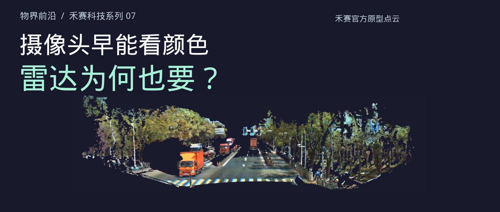
Full-color point cloud prototype demonstration from Hesai's April 2026 release materials. This is not a photographic image or a measured mass-production result.
In a road point cloud displayed by Hesai, a truck appears orange, roadside trees carry green, and crosswalk markings show light and dark detail. From a distance it looks like a photograph, but zooming in reveals the individual points that make up the scene. Each point has both a three-dimensional position and a color.
This image comes from the full-color radar prototype demonstration Hesai announced in April. It uses the company's self-developed "Picasso" chip to combine color sensing and laser ranging, directly outputting spatial data with color. Cameras and radar could already work together to accomplish this before, but Hesai wants to complete the correspondence between color and distance at the chip level.
Cameras have long been able to capture color images. But accurately matching the orange truck in a photo to the truck measured in a point cloud still requires additional processing. Full-color radar attempts to reduce precisely this part of the work.
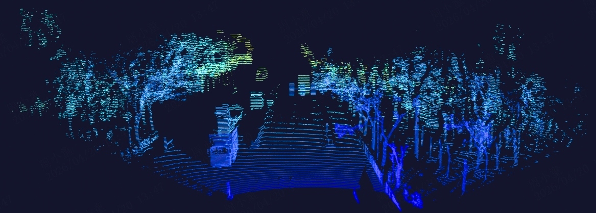
Conventional point cloud display from Hesai's April 20, 2026 English release materials. Blue-green is used to show spatial information, not the true RGB color of objects. The company notes these images are prototype results from the ETX platform.
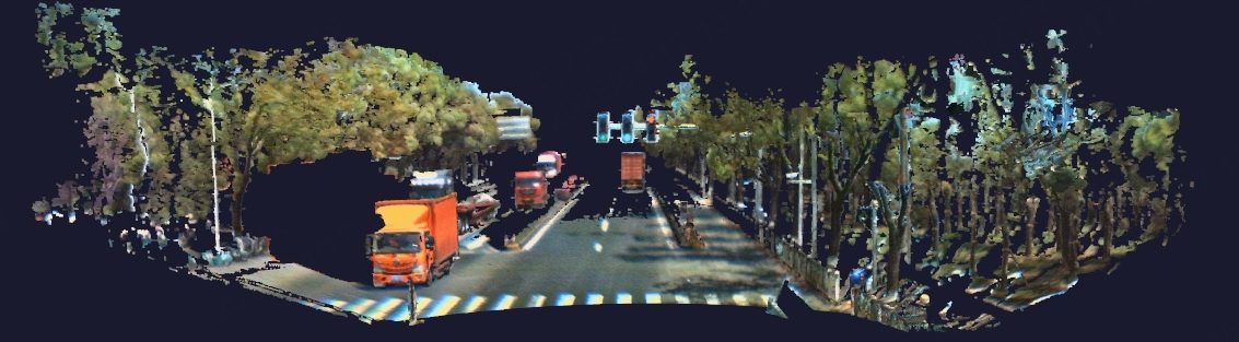
Picasso full-color point cloud from the same Hesai materials, showing colors of the truck, trees, and road. The two images illustrate the difference in data representation and cannot be used to calculate recognition rate improvements; mass-production versions are subject to customer customization and actual delivery.
What a Color Photo Still Lacks
Cameras record color and texture in a scene. LiDAR measures the round-trip time of light signals to calculate object distances, then assembles a large number of measurements into a point cloud—a set of points with spatial positions.
To combine photos and point clouds, engineers need to know where each sensor is mounted and which direction it faces, then convert their coordinates into a common frame. This process is called calibration. The relationship between a pixel in the image and a position in the point cloud must also be established.
Time must also be aligned. If a truck is moving and the two datasets are captured at different moments, the truck in the photo and the truck in the point cloud may be at different positions. Software must align both space and time to assign colors to the corresponding 3D points.
This approach already has mature implementations. The KITTI dataset, commonly used in autonomous driving research, provides color camera images, laser point clouds, and calibration files between camera and radar. It also distinguishes raw data from synchronized and rectified data. Having the two types of sensors work together has always been a viable approach.
Which Step Hesai Put Into the Chip
"Picasso" integrates color sensing and time-of-flight ranging into a single chip. Time-of-flight ranging is the method described earlier—calculating distance from the round-trip time of light. According to Hesai's disclosures, the chip acquires corresponding color and depth at the pixel level, and the radar directly outputs a color point cloud.
The company calls it "6D." The six pieces of information here are the three-dimensional position X, Y, Z, plus the three color channels red, green, and blue—R, G, B. It still describes a three-dimensional world, except each spatial point also carries color.
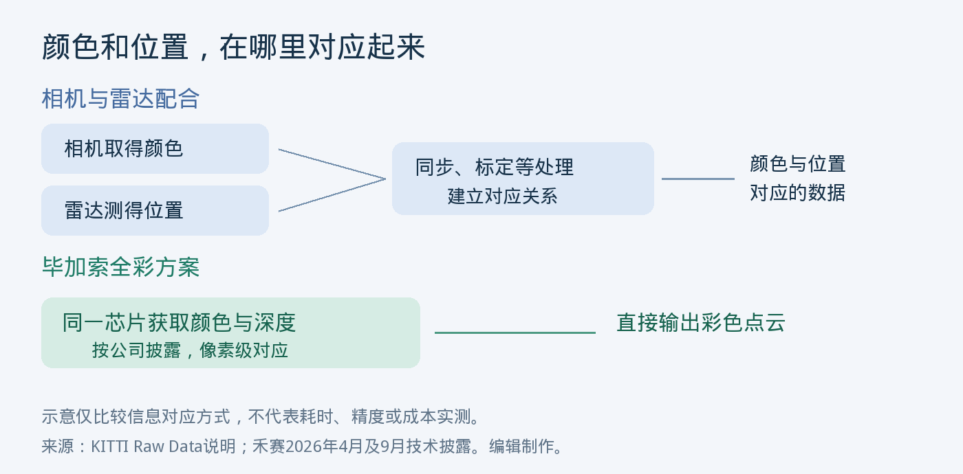
Editor's illustration based on KITTI data documentation and Hesai chip disclosures. The diagram only compares how color and position correspond; it does not represent measured differences in processing time, accuracy, or cost.
Traffic lights, lane markings, and construction signs are all potential use cases listed in Hesai's release materials. These objects contain meaningful color information. Delivering color and position together to software can increase the data available for judging a scene.
But color is only input. What a red object is and whether the vehicle needs to stop must still be handled by recognition and decision systems. Official point clouds can show what the data looks like, but cannot prove a vehicle's misrecognition rate or collision avoidance performance from imagery alone. The public materials also do not provide a complete same-condition comparison test of this approach against a camera-plus-radar combination.
Who Needs Less Data Processing
Hesai's September 15 announcement of its collaboration with JD.com addressed the data preparation stage. The company states that natively acquiring color and depth can reduce synchronization, calibration, registration, and 3D annotation processes in traditional approaches, shortening the pipeline from real-world data collection to model training.
Registration can be understood as mapping data from different sources to the same scene; 3D annotation means adding categories, boundaries, and other information to objects in space. To train models, customers need to organize these relationships clearly in addition to collecting images. If color and distance already correspond at the time of collection, subsequent processing has the opportunity to do less work.

Original text of Hesai's September 15, 2026 JD.com collaboration announcement, explaining the processing steps that full-color data is intended to reduce. This is the company's description of the solution's purpose; no measured figures for labor hours or cost savings are disclosed.
This is also the most practical difference between full-color radar and ordinary color photos. What customers need is data where color and spatial position correspond. Whether it can be collected reliably and whether it integrates easily into existing training pipelines will affect its value. The company has not disclosed the procurement volume, unit price, or dedicated revenue of full-color radar in this JD.com collaboration.
The same announcement lists JD.com's "Lone Wolf" sixth-generation intelligent delivery vehicle Plus edition, which is equipped with Hesai's AT-series radar. It already has a public vehicle configuration, while the full-color data collaboration is a separate direction of progress. The announcement does not provide batch delivery records of this delivery vehicle switching to full-color ETX.